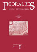
La luna de España: Mapas, ciencia y poder en la época de los Austrias
Abstract
Through different approaches, the Moon and celestial spaces were present in Early Mod ern reflections. This article deals with them specially by means of a fictious sideral voyage
written by Juan de Maldonado in 1532 and the Lunar topography established by the lead ing Antewrp cosmographer Miquel Florenz Van Langren during the 1630's. Besides giving
the opportunity for description of curious costums, the former, or for a unique Lunar nomen clator honouring the House of Habsburg, the latter, both cases show the strong presence
of maps and graphic representation of the Earth in contemporary culture. This feature, wich
lies in Philip II’s cartographic education, is placed in relation to the practice by himself and
Philip IV, and also by other rulers, to keep maps and cartographical information hidden, as
if they were state secrets, by a time of increasing international concurrence in the political,
military and scientific arenas.
Downloads
Published
How to Cite
Issue
Section
License
Copyright (c) 2005 Richard L. Kagan

This work is licensed under a Creative Commons Attribution-ShareAlike 4.0 International License.
Authors must agree with the following terms:
1. The author keeps authorship rights, ceding the journal the right to first publication.
2. Texts will be disseminated with a Creative Commons Attribution 4.0 International License. Which allows for the work to be shared with third parties, as long as they recognise the work’s authorship, the original publication in the journal and licensing conditions.
This requires acknowledging authorship appropriately, providing a link to the license, and indicating if any changes have been made. It can be indicated in any reasonable way, but not in a manner that suggests the licensor endorses or sponsors the use of the text.
If content is remixed, transformed, or new content is created from the journal's texts, it must be distributed under the same license as the original text


